El Sharkia Governorate
El Sharkia Governorate was the twelfth province of Lower Egypt; its Capital was Bobastis which became later The Capital of Egypt.
This governorate was founded during the reign of the Fatimid era before that it was divided into several villages, then they were combined together and named the Eastern region or ( El Sharkia ). When Mohamed Ali ruled Egypt in 1805, at this time Egypt was consisted of 13 state divided into 7 states in upper Egypt and 6 in Lower Egypt.

El sharkia government was one of the Lower Egypt states and the oldest, it was managed by someone called the Supervisor (El Kashef).
When Mohamed Ali ordered to make a general survey to the Egyptian agricultural land in 1813, he instructed to divide the states into parts each headed by an employee known as the Monarch of that part to organize the village’s business and to facilitate the supervision on them, each part is divided into small parts and ruled by Mayor.
In 1829 El Sharkia was annexed under the banner of the directorate of the lower Egypt territories after the partition of Egypt in to three regions are : The Lower Egypt territories , the upper Egypt territories and the central territories Location : El Sharkia governorate takes a unique location among the Eastern Delta governorates and mediates the Delta, It’s capital is El Zaqaziq , it was the central point for the main roads which lead to ( EL Esmailia , Port Said , Cairo, El Dakahlia and El Kaliobia ).
Its natural location made it as fort to be as the Eastern guard to the Republic to defend against any foreigner invasion coming from East.
Slogan : The Governorate takes the conservative white horse which mediates the green color as a slogan as for its excellence in breeding The Arabian Horses ,( Green color ) because of the great agricultural space in El Sharkia National Day : El Sharkia celebrates its national day on the ninth of September of each year ,commemorate the Egyptian leader Ahmed Orabi who stood against Khedive Tawfeek in Abdeen Square ,Cairo offering the army’s demands in 1881.

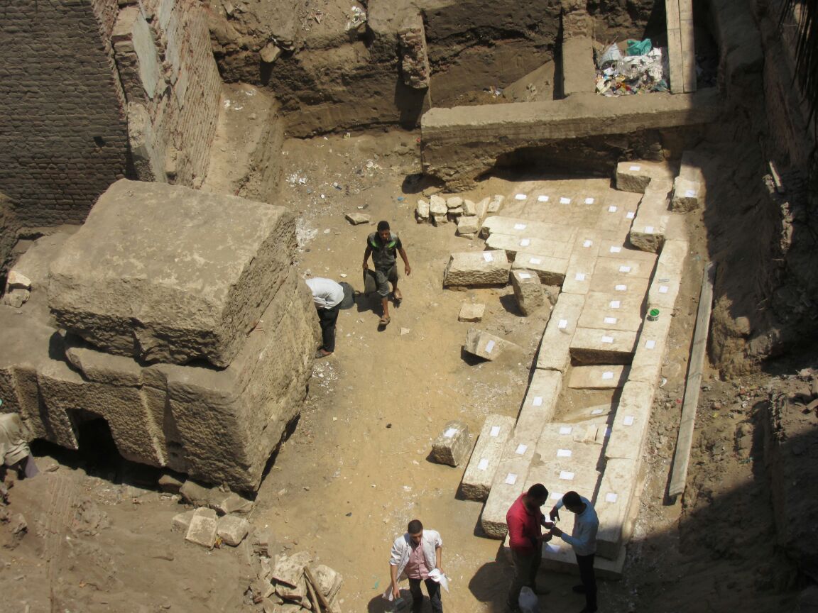
Population: El Sharkia is considered as the second governorate in Egypt after Cairo in its population which is around 13.6 Million People, representing 38% urban and 62% countryside Area: El Sharkia Governorate is 4911 Km2,which equivalent to 1169285 acres Agriculture El Sharkia Governorate is famous for cultivation of the following crops (cotton – wheat – rice – corn – beans – Beet Sugar ), and also planting fruit (mango – citrus fruits – grapes – date), and also contribute to the cultivation of some medicinal plants. Industry Sharkia Governorate consists of Tenth of Ramadan City which is an industrial city contains a number of factories, and the city Obkber which now became a famous area of the garment industry, which has spread in recent and includes many of the garments factories and embroidery in addition to being a country of large commercial , agricultural companies by: company Mary Land for Agricultural Development Bilbeis Street Olokuil new – Saadoun Tourism A – Cultural Tourism At Sharkia Governorate has about one hundred archaeological site, The most famous of these sites are : Zaqaziq : Tell Basta, city of the cats (House of Bastet, the cat goddess).
The site covers a considerable area and it was the capital of the 18th nome of Lower Egypt.
The granite Temple of Bastet, excavated by Naville in 1887-89, is very ruined.
Its main feature is the Festival Hall of Osorkon II and the structure seems to have been located on an island in the sacred lake.
The foundation of the temple goes back to the 6 Dyn, also there are the 6 Dyn. Ka temples of Pepy I and Teti and there are also 12 Dyn. Chapels of Amenemhat III and an 18 Dyn. Chape/ of Amenhotep HI.
Extensive animal burial places, particularly cats associated with Bastet, have been found. A small temple is thought to be that of Mihos, son of Bastet.
Apparently several important officials of the 19—20 Dyns came from this city and recently the tombs of two Viceroys of Kush (called Heri) have been found, as well as one of the vizier Ituti. Osorkon III seems to have built a temple to Atum here.
Also recently unearthed was the 12 Dyn.
palace of a local prince, with two rows of six column bases and some statues.
It was occupied during the Second Intermediate Period (1750-1570 BC) and abandoned in the early New Kingdom not to be resettled until the reign of Nectanebo II (360-343 BC) when it was used during the recutting of the canal linking the Red Sea with the Mediterranean.
Lack of relevant pottery indicates it was not occupied during the Ramesside period.
In 1978 an expedition from the University of Toronto and the American School of Oriental Research excavated this site.
There is a cemetery of the 2C was exposed; it consisted of built brick chambers containing single and multiple burials with children’s bodies buried in amphorae.
Although robbed, a considerable amount of material had been overlooked.
In the central part of the tell 5C BC Persian Period levels were unearthed which included a fine limestone building.

Beneath this level there seems to be a Hyksos level with material from Middle Bronze II of Syro/ Palestinian type. Kafr Nigm : the site of Pharbaethos.
Here material of Harnesses II and later was excavated (now in various museums, including Hildesheim). Faqus: just N of which lay ancient Phakusa.
From here, There are several sites potentially of great historical significance, all N of the road.
At al-Khata’nah (6km) the first site is Tell al-Qlrqatah which has remains of the 12 Dyn., a granite gate of a chapel of Amenemhat I and Senusert III.
E is Tell al-Daba’r an extensive site currently under excavation by an Aus¬trian mission.
This was important in the Second Intermediate Period and may have been the site of the Hyksos capital of Avaris.
Apparently abandoned during the 18 Dyn.
it was reoccupied during the 19 Dyn.
when a large temple was built which seems to have been dedicated to the god Seth.
The NE part of the tell was occupied during late Hyksos times whereas the central areas were inhabited earlier, in the 12-13 Dyns.
The NE houses were of simple plan consisting of a single room with a large ante chamber. Excavation of the bodies in the cemetery suggest that the men were of foreign origin while the women were local Egyptians.
No traces of the burning of Avaris were found. Just to the N is ‘Azbat Rushdi al-Saghirah with remains of a Middle Kingdom town and a temple apparently built by Amenemhat I.
At Qantir (9km) is a site excavated in the 1920s, though there is little now to see, since when it has been one of the contenders for the site of the vast Pr Ramsses, the Delta capital of Harnesses II.
Quantities of 19-20 Dyn. glazed tiles bearing floral designs, animals and fish were found here (now in the EM).
To the N is Tell Abu ‘1-Shafi’a with the remains of a temple probably of the 19 Dyn.; the base of a colossus of Harnesses II has also been found.
Beyond Qantir the next village is al-Husayniyyah (18km), just past which is the site of Tell Fara’un (Mound of the Pharaoh), Ancient Egyptian Imet, and later Nabasha, capital of the 19th nome of Lower Egypt.
The mounds of debris covering the site were partly cleared by Petrie in 1886.
He found the remains of a Temple of Wadjet, goddess of Lower Egypt.
From al-Husayniyyah to the large site of San al-Hagar (88km), ancient Djane, later Tanis-, although it was inhabited by the Hyksos, it is uncertain if it was the site of their capital Avon’s. (WC near the French Mission Resthouse.) This important town mound has been investigated over a number of years.
Material from here was removed in 1825 by Drovetti.
Between 1860-80 Mariette worked here for the government and in 1886 Petrie for the EEF. The French under Montet excavated here between 1927-55, since when it has remained in the French concession.
Its history dates from the Old Kingdom and remains of the 4-6 Dyns have been recovered. In the Middle Kingdom it was an important town and royal statues of the 12-13 Dyns have been found, some usurped by the Hyksos ruler Apopi.
Visible remains are of a large Ramesside Temple of Amun, entered through a monumental gateway leading to a forecourt.
On the S are the remains of the 21-22 Dyn. Royal Necropolis (closed to the public) discovered by Montet in 1939—40 (objects in the EM). Excavations on the S side of the mound cleared the first pylon of a Temple of Amun.
In the SE angle a foundations deposit was discovered consisting of three plaques, one bronze, one silver and one lapis-lazuli bearing the name of Osorkon II (874-850 BC), To the S the perimiter wall of the town was buttressed at regular intervals. Beyond Faqus is al-Salihiyyah, founded in the 13C by Sultan al-Salih Ayyub to assist pilgrims on the journey to Mecca.
Beyond Sinbillawayn (15km) is the village of al-Baqliyyah, to the S of which are three low mounds marking the site of ancient Bah, Gk Hermopolis Parva, capital of the 15th nome of Lower Egypt.
The northernmost is the Tell al-Naqus (Mound of the Bell) which probably indicates the town and the temple dedicated to the god Thoth. An inverted capital lying among the ruins gives the mound its name.
Found here was a 26 Dyn. naos dedicated by Apries to Thoth (now in the EM).
Another mound, the Tell al-Zereiki (Zirayki), probably contains the ibis cemetery. B – Religious Tourism Sharkia was the host of the Prophets, where lived Prophet Yusuf.Moses the “prophet of God “who was born in Sharkia and his mother threw him in the sea Btaputh Altanisy a section of Neil, who is likely that the canal and picked by “ Pharaoh “ at Tanis and raised in Egypt . C – Sports Tourism Sharkia is known as a breeding area of the eastern Arabian horses, which have become a symbol for the slogan of the Governorate .
Hockey, Hockey team achieved twelve African championship which considered as a record of athletic achievement registered by the international sports encyclopedias.


